Strengthen the community resilience to the rapid rise of the Lake Tanganyika through the use of open data - Event Report
- Date
- Saturday 6 March 2021
- Location
- Uvira, Democratic Republic of the Congo (Europe, Middle East & Africa)
- Organisers
- Mijas Multimedia
On Saturday 6th March 2021, the eleventh Open Data Day took place with people around the world organising hundreds of events to celebrate, promote and spread the use of open data. Thanks to generous support from key funders, the Open Knowledge Foundation was able to support the running of more than 60 of these events via our mini-grants scheme.
This event received an Open Knowledge Foundation mini-grant thanks to support from Microsoft.
How did your event celebrate open data?
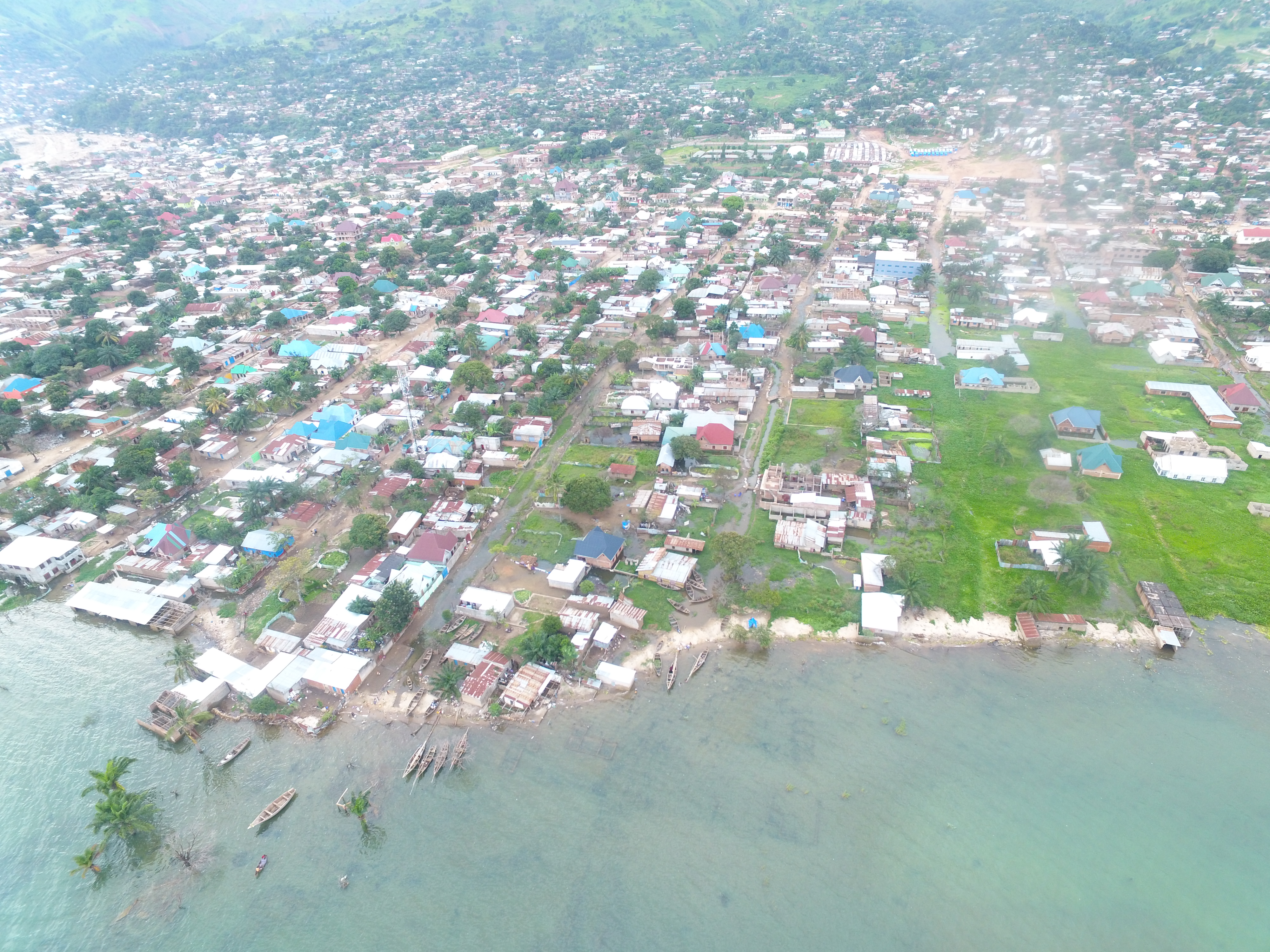
The water level of Lake Tanganyika in the African Great Lakes region is dangerously rising. Since 2015, up to 100 meters of lands have been taken by water destroying houses and threatening many others in various coastal cities in the Democratic Republic of the Congo, Burundi, Tanzania and Zambia.
In the framework of finding adaptive measures due to the rapid rise of the lake and strengthen the resilience of populations living in the risk areas. On the occasion of Open Data Day 2021, Mijas Multimedia organised an event whose overall goal was to use open data in strengthening the community resilience to the rapid rise of Lake Tanganyika. The project aimed at raising the awareness to the local community on the use of risk data in protecting exposed citizens.
During the event, more hands-on than theoretical activities were carried out including;
• Spatial image comparison and analyzing: this process comprised of taking up to date spatial images in the field with drone
• Image analysis: this process consisted of comparing spatial images taken by drone in the field with out-of-date images from Google Maps (after analysis we realized that the Google Maps image of the city is from 2019) in the goal of understanding the advance level of the lake and project next social economic infrastructures
• Risk communication: this process consisted of sharing the data through various formats including spatial mapping and media outreach in the aim of informing those living under risk areas
After the event’s completion, the local authorities promised to take into account data produced during the event in reducing the disaster risk to exposed communities living at the coasts of Lake Tanganyika.
Lessons learned from your event
We’ve learned various lessons during and after the event’s completion including;
• The lack of knowledge of local authorities on how to tackle the rapid of Lake Tanganyika and the ignorance about the existence of the open data concept
• The authorities’ involvement in the promotion of open data through the increasing of data transparency
Why do you love Open Data Day?
Apart from defending the open data concept across the world, Open Data Day is the event that covers some local challenges in giving them an international outreach. It also helps the open data practitioners realise their respective projects locally and give them the opportunity to fly with their own wings.