Collaborative and Humanitarian Mapping #1: OpenStreetMap introduction (Open Data Day) - Relatório do Evento
- Dia
- Friday 5 March 2021
- Horário
- 16:00 (CET)
- Local
- Online, Italy (Europe, Middle East & Africa)
- Organizadores
- PoliMappers
No sábado, 6 de Março de 2021, o décimo primeiro Dia dos Dados Abertos foi realizado por pessoas de todo o mundo através da organização de centenas de eventos para celebrar, promover e disseminar o uso de dados abertos. Graças aos generosos suportes, a Open Knowledge Foundation foi capaz de apoiar a realização de mais de 60 destes eventos através nosso esquema de minibolsas.
Este evento recebeu uma minibolsa da Open Knowledge Foundation graças ao suporte de Microsoft.
Como seu evento celebrou os Dados Abertos?
OpenStreetMap Introduction was the first event of the course 'Collaborative and Humanitarian Mapping', organised by PoliMappers and coordinated by Prof. Maria Antonia Brovelli (faculty advisor for PoliMappers), in collaboration with Politecnico di Milano and many realities active in the field of open mapping.
The event took place on March 5 from 16 to 19 CET in virtual mode and was attended by more than 90 people, including students of Politecnico di Milano, with a strong diversity of backgrounds.
During the event, participants were introduced to the world of collaborative mapping through an overview of the OpenStreetMap project, its uses, and the most common tools available to contribute. The YouthMappers network and the PoliMappers group were also introduced.
In the second part of the event, we had the honour of hosting Dimitris Karakostis, Technical Manager and Senior Geospatial Officer at World Food Programme, who explained to the participants how WFP uses OpenStreetMap data to update its mapping resources and thus provide optimal support to people working in the field.
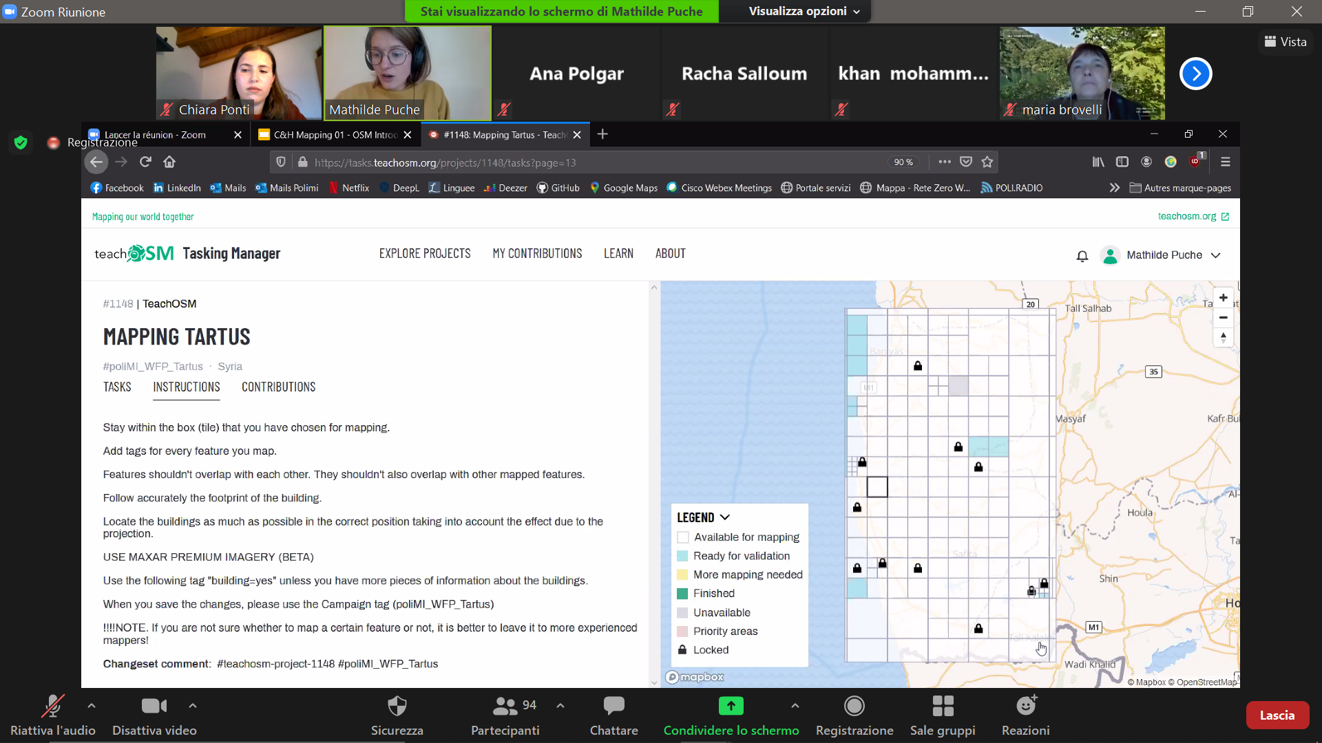
Finally, in the third part of the event, we provided a short tutorial to learn how to map the simplest features, namely buildings, with iDeditor. Participants then collaborated on mapping project 1148 on TeachOSM "Mapping Tartus", created to enrich the geographical information of that area of Syria, where WFP is operating.
Lições aprendidas no evento:
Thanks to the event, as organisers we were able to see that the interest in collaborative and open mapping is shared by people with very different academic/professional/personal backgrounds from all over the world. In particular, considerable curiosity emerged in relation to the tools and technologies that can be used by anyone to contribute to mapping for humanitarian purposes.
As for the participants, they acquired basic mapping skills that will be enriched during our upcoming events and, in general, the usefulness of the contributions, as they are closely related to the work of WFP, has been enhanced.
Finally, the practical part of the event produced excellent results in terms of quantity (more than 50 OSM users mapped over 5000 buildings) and quality (the contributions were validated by the PoliMappers team and in general a good level of mapping was found).
Porque você ama o Dia dos Dados Abertos?
We love Open Data Day because it's an opportunity to introduce many people to the world of open data, especially regarding geographic information in our case. During this annual celebration people can understand the benefits of open knowledge, often even contributing personally.
Você ou seu time produziu algum recurso (conjunto de dados/ferramenta/mapa/código/etc) durante sua celebração do Dia dos Dados Abertos?
Presentation slides: [https://drive.google.com/file/d/1n3a4neTQm_BXhVrpRsamRKH4dgAV2agR/view?usp=sharing](https://drive.google.com/file/d/1n3a4neTQm_BXhVrpRsamRKH4dgAV2agR/view?usp=sharing